Geo Earth Mapping - Emergency Evacuation Plans & Site Plans
The main purpose of this area of mapping is to bring GIS technology to emergency responders conducting emergency response activities. GIS is primarily used for quick reference to determine infrastructure as well as the surface the land and to determine the most optimal evacuation routes as well as confirmation and/or identification of sensitive environments within the area(s) of a response action. In some circumstances, it is used to relay detailed information back to the office and/or Emergency Operations Center to aid with communications and effective decision making.
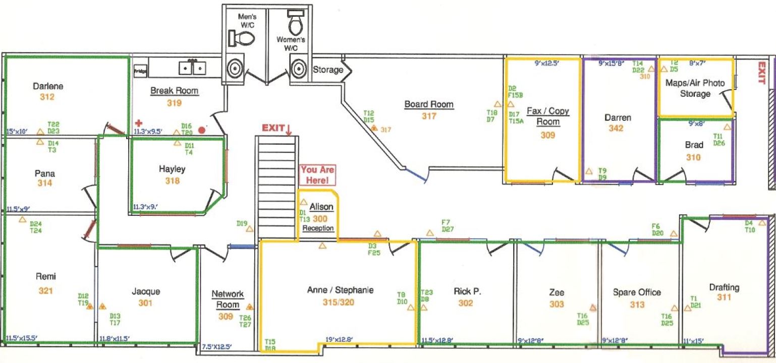
Emergency Evacuation Plans
We also create siteplans of buildings and facilities conforming to WorkSafe and fire safety standards for event planning and emergency evacuation purposes.
Floor Plan used for Emergency Evacuation
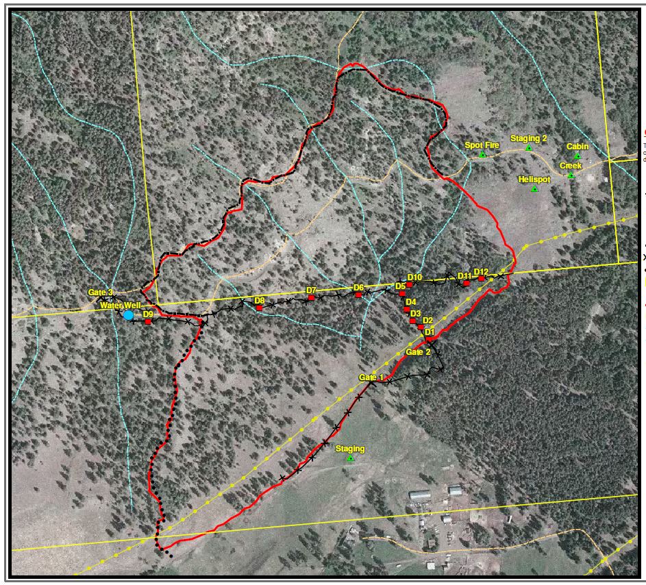
Fire Interface Mapping and Fire Rehabilitation Plans
Potential environmental threats are forest fires and pest infestations such as the beetle problem that is affecting most of B.C. Areas that are located on the fringes of urban and wilderness areas are at risk. These are known as interface areas. Fire Rehabilitation plans are required in areas of fire suppression activities to ensure that drainage patterns are maintained and surface soil erosion is minimized..
Fire Rehabilitation Plan