Geo Earth Mapping - Recreation & Tourism
GIS assists in the management of greenways, parks, forest preserves, and recreational areas which has become increasingly significant as land development progresses.
Recreation Tenure Maps
We recognize the ever changing needs of the resort and recreation industries, the move to expanding operations and the need for new approaches to resort development. We also create digital data conforming to standards for tenure submission and export the data to KML for viewing in Google Earth
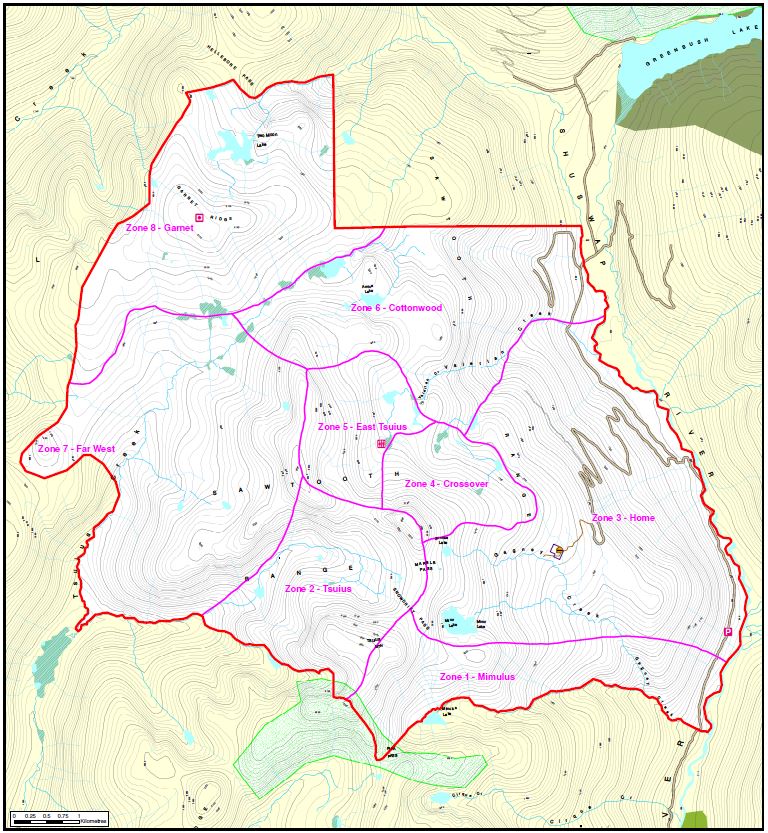
Commercial Cat Skiing Operation Tenure Map
Recreation Brochure Maps
We provide a full range of mapping services to enable organizations involved in recreation or tourism to efficiently manage trails, routes and run inventories, and assist in the transition from single season to multi-season use. Services offered include: site plans, operation plans, evacuation plans, brochures, posters, trail location development, terrain and slope analysis and graphic design.
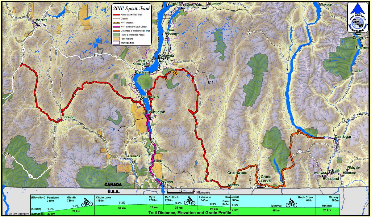
2010 Spirit Trail, BC, with Elevation Profile
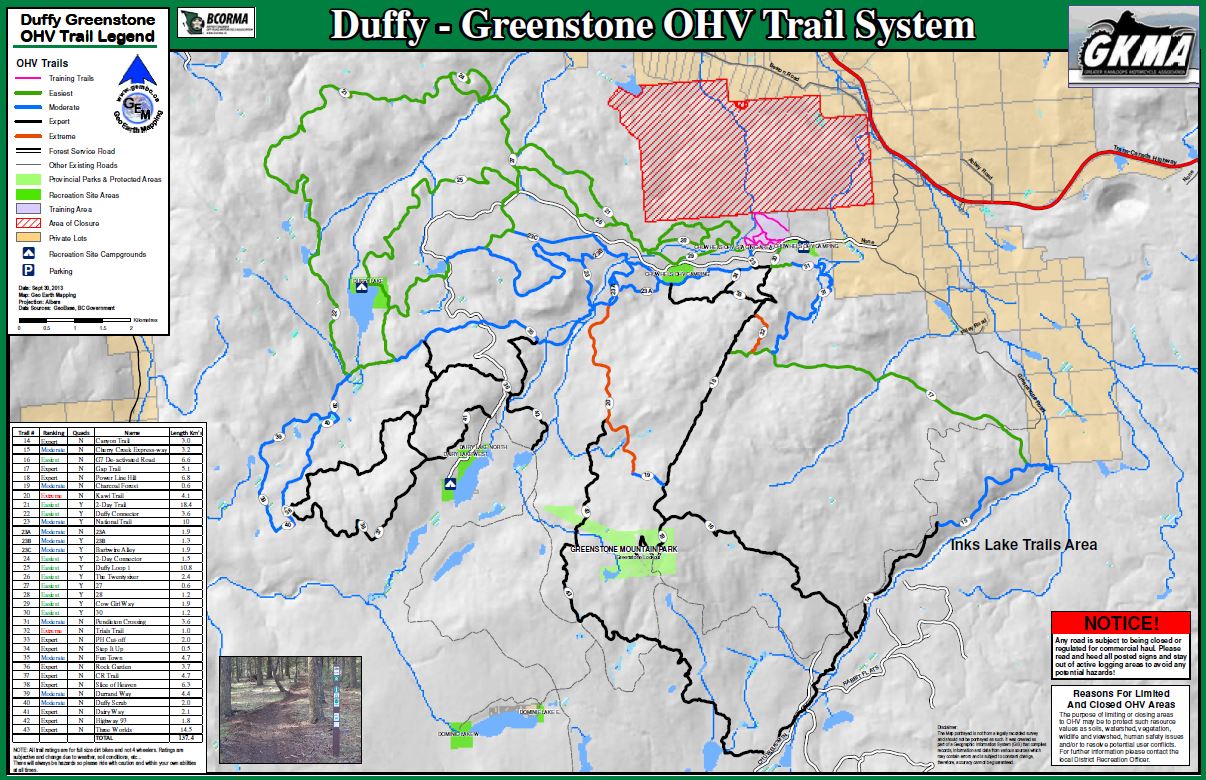
Duffy-Greenstone Off-Road Vehicle Trail Map